Introducing the Loupe: A Mobile TDEM Conductivity Mapping System
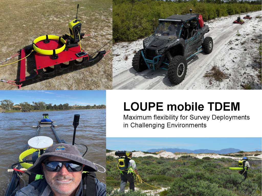
The Loupe is a mobile time-domain electromagnetic (TDEM) conductivity-mapping system designed to provide high quality, high-spatial-resolution data efficiently across a wide range of terrains. Operated by personnel on foot or towed by all-terrain vehicles (ATVs), the system enables rapid mapping of conductivity variations from the near-surface to depths of approximately 40 metres. Its mobility, rapid data acquisition, and real-time visualisation capabilities provide an efficient approach to characterising subsurface conditions over large areas.
Understanding Time-Domain Electromagnetics
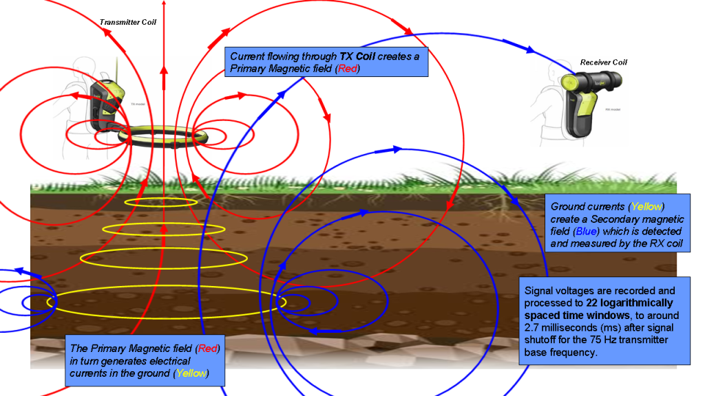
Time-domain electromagnetic (TDEM) surveying is a geophysical technique in which electric and magnetic (EM) fields are induced by transient pulses of electric current and the subsequent decay response is measured to investigate the electrical properties of the subsurface. The process involves generating a time-varying current into a transmitter loop or coil. The transmitter loop then generates an EM wave that propagates into the subsurface and, as the EM energy encounters different subsurface materials, it induces eddy currents that generate secondary EM fields. These secondary EM fields are detected at the surface by a receiver coil and recorded as the induced energy diffuses into the earth. The rate of diffusion indicates the resistivity of the subsurface materials and is quantified by measuring the change in amplitude of this EM field at a number of fixed times or channels.
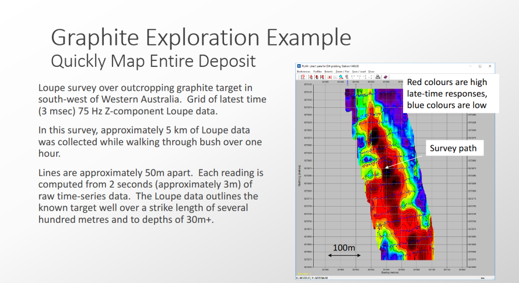
TDEM and other electrical geophysical methods are frequently used in environmental and hydrogeological investigations, where conductivity variations can reflect differences in soil texture, moisture content, fluid salinity, and geological composition. Other applications include groundwater studies, managed aquifer recharge, dam seepage investigations, and saline mapping. The mobility and high-resolution profiling capabilities of the Loupe also creates opportunities for mineral exploration, including the mapping of conductive targets associated with metal sulphides, graphite, manganese, and gold. In addition, it can support mapping hazards in open-cut mining operations and investigating conductive ore bodies and stratigraphy in underground mines.
Bridging Depth, Detail, and Survey Efficiency
Geophysical site investigations often require a balance between depth of investigation, level of detail, and survey efficiency. Direct-current electrical resistivity imaging or tomography (ERI/ERT) methods provide detailed models of the subsurface resistivity distribution and achieve good depth of investigation. However, data collection can be relatively time-consuming, particularly for larger-scale site investigations.
Frequency-domain electromagnetic (FDEM) systems, by comparison, enable rapid, continuous data collection without direct ground contact. While this method is well suited to efficiently cover large areas, the resulting bulk electrical conductivity measurements offer more limited depth information.
The Loupe offers an alternative through mobile TDEM profiling, combining continuous data acquisition with sensitivity to subsurface electrical properties at depth. Its configuration supports efficient survey coverage while providing detailed conductivity profiles to help characterise variations in the subsurface.
Designed for Flexible, Real-Time Field Operations
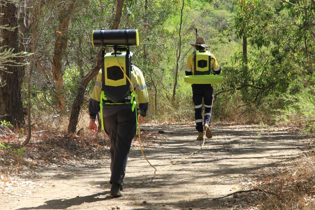
The Loupe uses a transmitter and receiver carried by separate operators and connected by a cable. Ergonomically designed backpacks support the equipment and distribute its weight behind the operators, facilitating fieldwork across multiple terrains.
Designed for continuous profiling with a variable transmitter-receiver separation, the system can be adapted to different survey objectives and site conditions. An included field tablet provides data logging and survey-track guidance through a wireless connection to the data acquisition system in the transmitter backpack. The system incorporates a three-component receiver coil sensor with 100 kHz bandwidth.
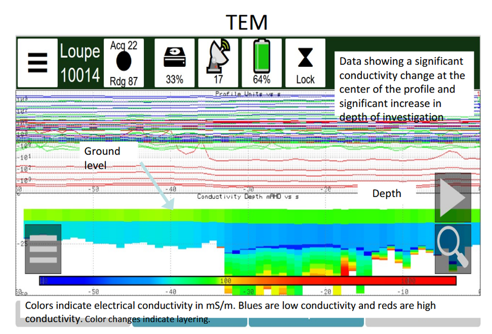
The user interface is web-based, allowing operators to use the supplied tablet or another WiFi-enabled device. Real-time displays of navigation, survey line paths, acquired data, and conductivity sections help operators assess coverage and make informed decisions while surveying. Base frequency, sampling interval, and survey line paths can also be adjusted in the field, providing flexibility to optimise acquisition parameters as project requirements and site conditions evolve.
Advanced Processing and Integrated System Features
The Loupe incorporates real-time processing capabilities designed to support data acquisition in challenging electromagnetic environments, including areas affected by power transmission lines and other sources of interference. Automatic very-low-frequency (VLF) signal filtering helps mitigate unwanted signals, while built-in RTK GPS supports precise positioning.
Additional features include 400GB of internal storage and hot-swappable batteries to support extended field operations. For applications requiring greater investigation depths, the system can also be used with third-party transmitters for conventional fixed-loop TDEM soundings, extending its versatility beyond mobile profiling.
Efficient, High-Resolution Subsurface Mapping
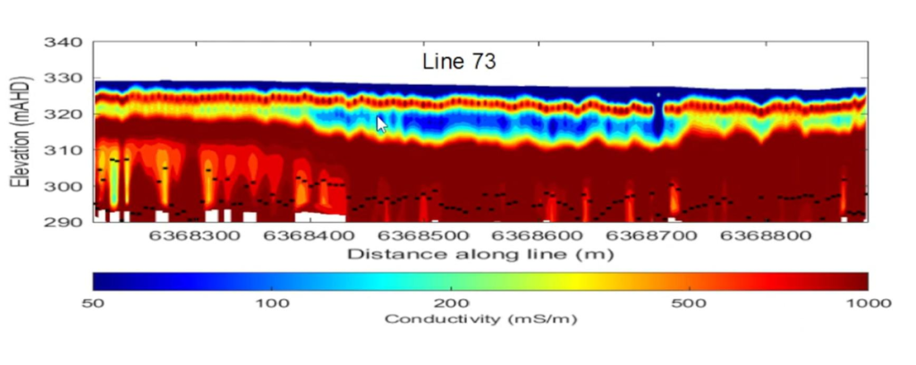
By combining mobile TDEM technology, rapid acquisition, real-time data visualisation, and flexible field configuration, the Loupe provides an efficient approach to mapping subsurface conductivity variations at high spatial resolution and depths of approximately 40 metres. Its continuous profiling capabilities generates information-rich datasets that supports detailed subsurface characterisation across a wide range of geological and environmental applications, helping project teams optimise survey coverage and streamline site investigations.
Flexible Options for Your Next Survey
Interested in bringing high-resolution, mobile TDEM surveying to your next project? The Loupe is available from Terraplus for both purchase and rental, offering flexible options to suit your project requirements, survey objectives, and budget.
Contact our team to learn more about the Loupe, discuss your application, or enquire about purchasing or renting the system.